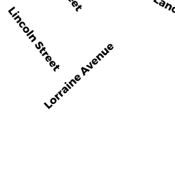
69 LANCASTER RD
Owner Information
BATES REGINA T
69 LANCASTER RD
CLINTON, MA 01510


Property Details
69 LANCASTER RD is classified as a Single Family Residential (Split-level).
The primary structure on this property was built in 1991. There are 4,168ft2 of built area within this property. There is 1,846ft2 of residential/living space within this property. This property is listed as having 6 rooms.
69 LANCASTER RD is valued at $346,600. The land is valued at $106,100 and the structures are valued at $239,800. There is an additional valuation of $700 on this property.
This property is in Zone R2. Confirm with local Zoning Board authorities to ensure there are no overlays or other easements on this property.
The most recent deed for 69 LANCASTER RD is recorded at the local registrar in Book 13460, Page 0099. 69 LANCASTER RD was last sold on Friday, June 14, 1991 for $38,000.
Assessment data from fiscal year 2022.
Flood Data
According to the FEMA National Flood Hazard Layer, this property does not appear to be in a flood zone. It may also be in an area not yet reviewed. Nonetheless, confirm this information prior to taking any action.
To view the flood hazards around this property, create a FEMA "Firmette" Map of the area around 69 LANCASTER RD.
Broadband Internet Providers
| Provider | Type | Bandwidth (mbps) | |
|---|---|---|---|
| GCI Communication Corp. | Satellite | 0 | 0 |
| HughesNet | Satellite | 25 | 3 |
| VSAT Systems, LLC. | Satellite | 2 | 1 |
| Verizon New England Inc. | DSL | 5 | 0 |
| Viasat Inc | Satellite | 100 | 3 |
| Comcast | Cable | 1000 | 35 |
Broadband service provider data from December 2020.
Adjacent Properties
- 6 FOX RUN DRIVE
Single Family Residential owned by MCDONALD FAMILY REALTY TRUST - 4 FOX RUN DRIVE
Single Family Residential owned by SOLDI STEVEN M SR - 71 LANCASTER RD
Single Family Residential owned by AZORANDIA PETER A - 4 DEER RUN CIR
Single Family Residential owned by KING, LAUREN - 2 DEER RUN CIR
Single Family Residential owned by BOUDREAU NICOLAS ANDRE - 65 LANCASTER RD
Single Family Residential owned by WILLIAM AND JENNIFER DEFORGE LIV TRUST